Bring the brolly out: South-eastern states set for a soaking over coming days

Millions of Australians are in for a rude weather shock from today when a run of sunny, warm weather over the school holidays ends, giving way to damp conditions.
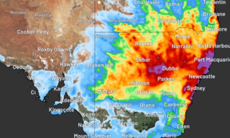
Large parts of eastern and south-western Australia can expect a soaking this week, bringing a risk of flooding in New South Wales and welcome drought relief for Western Australia.
Rain and thunderstorms, triggered by multiple upper-level troughs and low pressure systems, are forecast over coming days.
They will bring major rainfall and possible flooding for parts of eastern Australia.
A weak cold front will also mean a drop in temperatures from today after many parts of NSW enjoyed warm and balmy conditions over past days.
The mercury in Sydney hit a top of 28 degrees yesterday but it will feel much cooler today, with a maximum 22 degrees forecast.
But rain and damp conditions will be the main feature of the weather for the rest of the week.
The Bureau of Meteorology is forecasting 15mm to 30mm of rain every day from Tuesday, with potentially heavier falls on the weekend.
Meanwhile, in Western Australia, showers and thunderstorms will develop over western parts from today before it spreads south and east.
Accumulated rainfall totals of 5mm to 20mm are forecast, but some areas of the far south-west could see more than 50mm by the end of the week.
This week’s rain will be falling over parts of WA that have just endured their driest seven-month period on record, including Perth and Bunbury.


